


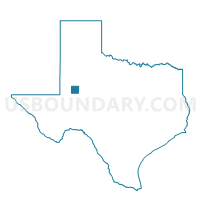
Voting District 0004, Martin County, Texas
About
Outline

Summary
| Unique Area Identifier | 675770 |
| Name | Voting District 0004 |
| County | Martin County |
| State | Texas |
| Area (square miles) | 117.54 |
| Land Area (square miles) | 117.53 |
| Water Area (square miles) | 0.02 |
| % of Land Area | 99.99 |
| % of Water Area | 0.01 |
| Latitude of the Internal Point | 32.34032030 |
| Longtitude of the Internal Point | -101.75485110 |
Maps


Graphs
Select a template below for downloading or customizing gragh for Voting District 0004, Martin County, Texas


Neighbors
Neighoring Voting District (by Name) Neighboring Voting District on the Map
- Voting District 0001, Martin County, TX
- Voting District 0002, Martin County, TX
- Voting District 0003, Martin County, TX
- Voting District 003A, Martin County, TX
- Voting District 004A, Martin County, TX
- Voting District 0103, Howard County, TX
- Voting District 0104, Howard County, TX
- Voting District 0105, Howard County, TX
Top 10 Neighboring County Subdivision (by Population) Neighboring County Subdivision on the Map
- Big Spring CCD, Howard County, TX (30,743)
- Stanton CCD, Martin County, TX (3,437)
- Big Spring North CCD, Howard County, TX (2,247)
- Tarzan-Lenorah CCD, Martin County, TX (1,362)
Top 10 Neighboring Place (by Population) Neighboring Place on the Map
Top 10 Neighboring Unified School District (by Population) Neighboring Unified School District on the Map
- Big Spring Independent School District, TX (29,015)
- Stanton Independent School District, TX (3,806)
- Klondike Independent School District, TX (721)
- Sands Consolidated Independent School District, TX (697)
- Grady Independent School District, TX (553)
Top 10 Neighboring State Legislative District Lower Chamber (by Population) Neighboring State Legislative District Lower Chamber on the Map
Top 10 Neighboring State Legislative District Upper Chamber (by Population) Neighboring State Legislative District Upper Chamber on the Map
Top 10 Neighboring 111th Congressional District (by Population) Neighboring 111th Congressional District on the Map
Top 10 Neighboring Census Tract (by Population) Neighboring Census Tract on the Map
- Census Tract 9509, Howard County, TX (3,577)
- Census Tract 9502, Martin County, TX (3,437)
- Census Tract 9501, Howard County, TX (2,247)
- Census Tract 9501, Martin County, TX (1,362)
Top 10 Neighboring 5-Digit ZIP Code Tabulation Area (by Population) Neighboring 5-Digit ZIP Code Tabulation Area on the Map
- 79720, TX (33,640)
- 79782, TX (3,976)
- 79713, TX (592)
- 79749, TX (255)
- 79783, TX (201)
- 79748, TX (173)